App Guide

App Guide

A comprehensive guide to every part of the app. If you're just getting started, head to Quick Start.

🧭Navigation
Free Navigation

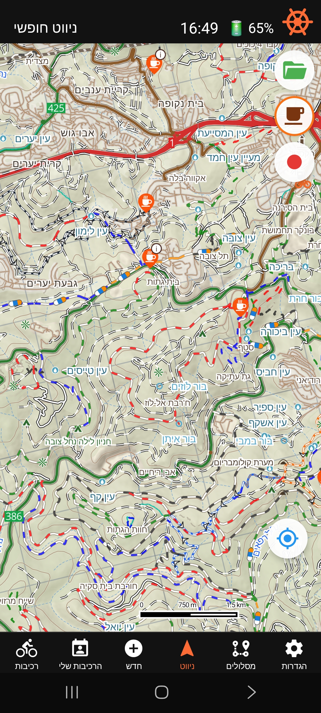
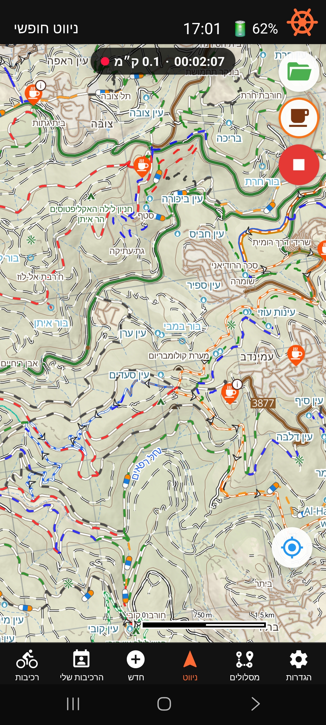
Free navigation screen

Free navigation screen

Open the Navigate tab. The map centers on your current position and follows you automatically as you ride.

Top bar:

  • Status label (left) — shows "Free nav"
  • Current time
  • Battery percentage
  • Map-mode icon (right) — tap to switch between North-Up and Heading-Up

Map modes:

  • Orange ship wheel = Heading-Up: map rotates with you, arrow always points forward.
  • Red compass = North-Up: map always faces north, arrow rotates with your heading.

The speed pill (bottom-left) shows your current speed in km/h. Pan or pinch to explore freely — auto-follow resumes after about 5 seconds once you start moving again.

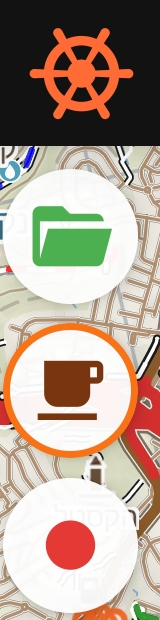
Navigation button panel
Button stack: map toggle · GPX folder · coffee POIs.

The Bishvil map loads automatically — there's no manual map switch. It only falls back to OpenStreetMap on its own, briefly, if the Bishvil map server is temporarily unreachable.

Buttons (right side by default; configurable in Settings → App → Navigation → Buttons side):

  • Green folder — load a GPX file from your device, or reopen a saved route.
  • Coffee cup — show cafes and bakeries with outdoor seating (premium; orange ring = active). See Coffee Points below.
  • Red video camera — record a GPX track of your ride and save it to Routes (premium). See Ride Recording below.
Bishvil keeps tracking your position and past trail in the background — even with the screen locked or another app open — for as long as you're on the Navigate tab. A quiet notification appears while this is active; tap its stop action if you want to end tracking without closing the app.
GPX Navigation

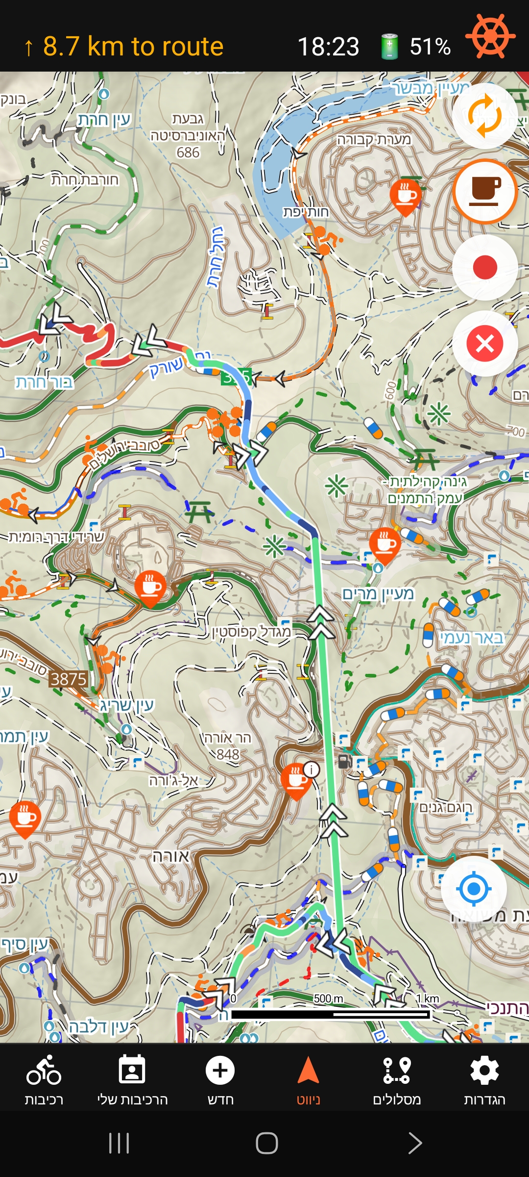
GPX navigation — slope colors and route metrics

GPX navigation with slope colors

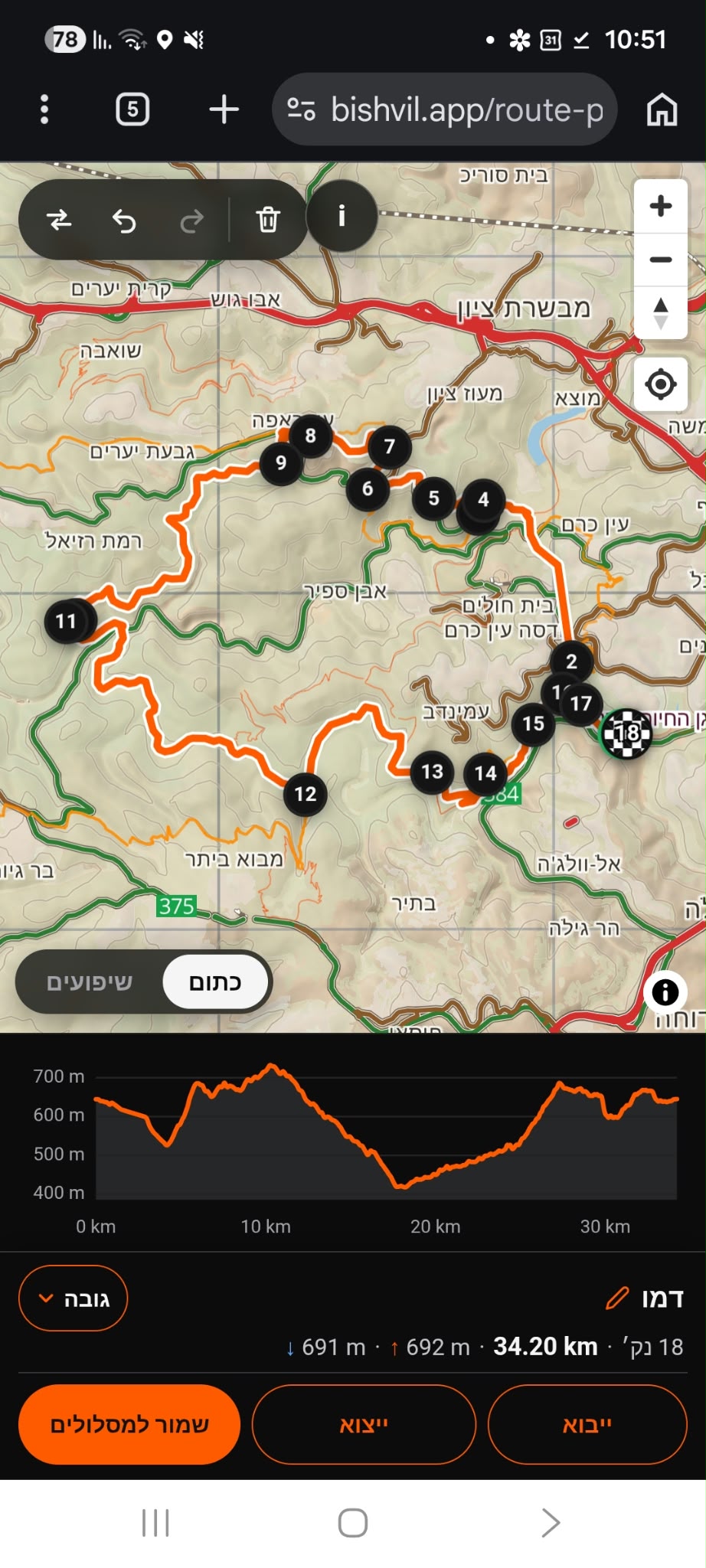
Tap the green folder button and select a GPX file. Files shared via WhatsApp or opened from Downloads load automatically.

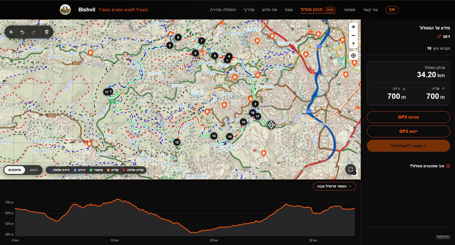
Route colors by slope:

  • Dark blue — steep descent (> 6%)
  • Light blue — descent (3–6%)
  • Light green — flat (−3% to +3%)
  • Orange — ascent (3–6%)
  • Red — steep ascent (> 6%)

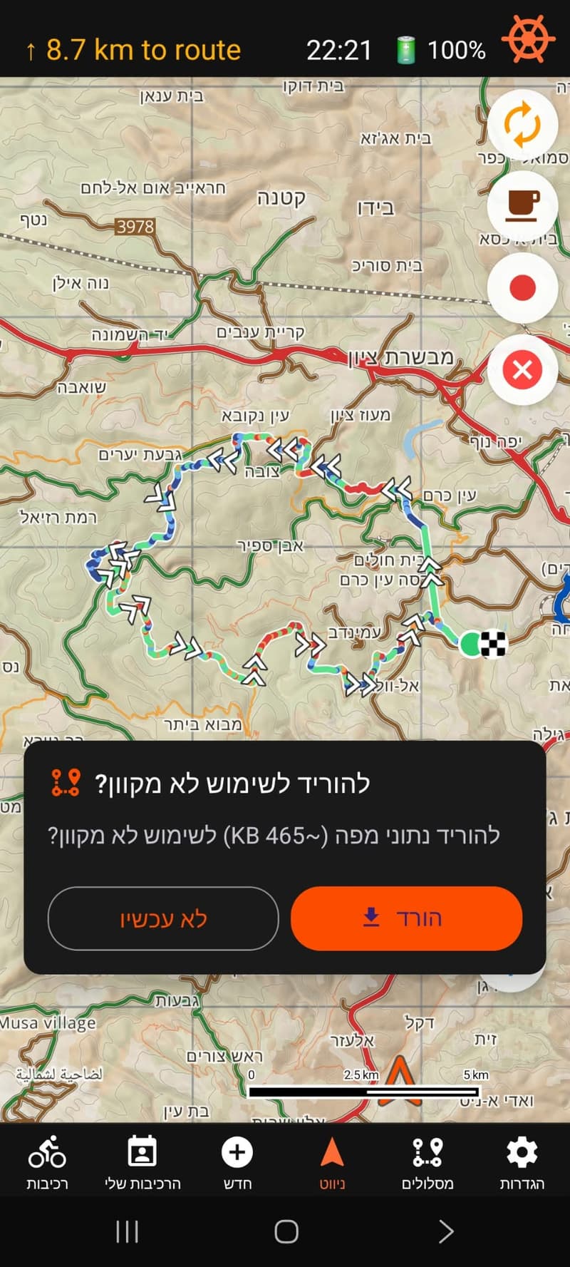
Direction arrows show which way to ride. Green dot = start, checkered flag = finish.

Top-left status:

  • Far from route — orange arrow + "X km to route" pointing toward the start.
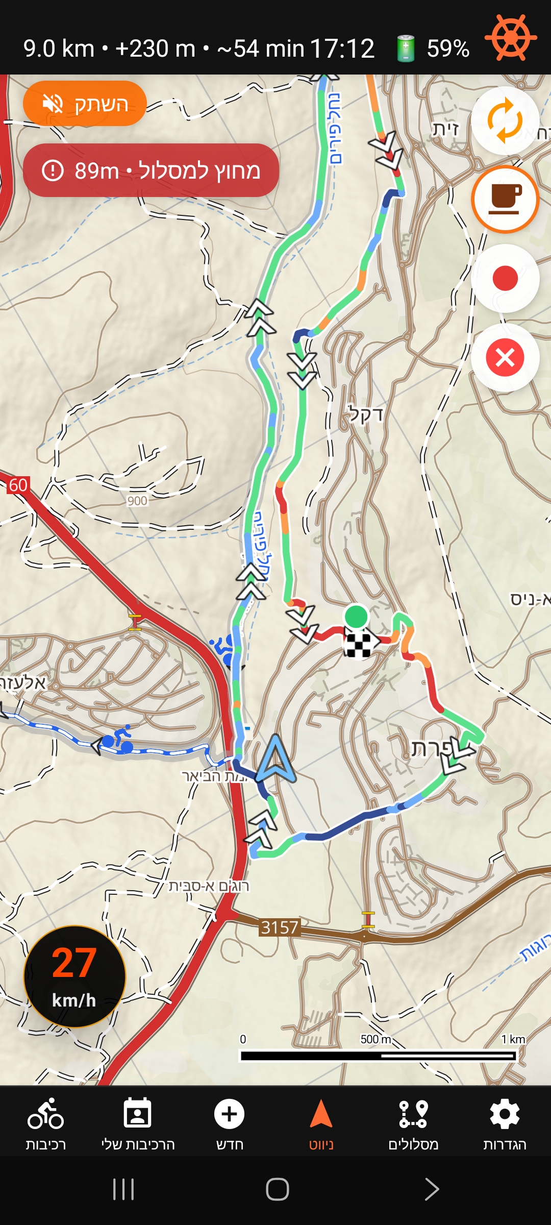
  • On route — remaining distance · elevation gain · ETA (e.g. "6.2 km · +420 m · ~45 min").
  • ETA adapts in real time to your actual climbing and descending speed.

Off-route alerts:

  • Top-left turns orange showing distance back to route.
  • Double beep plays once, then a subtle tick every 30 seconds.
  • Mute Off Route button appears to silence the ticks.
  • Single chirp plays when you return to the route.
Off-route toast and Mute Off Route button
Straying from the route shows a toast and a Mute Off Route button.

When GPX is loaded, the folder is replaced by a red X to clear the route.

GPX files from Strava, Komoot, Garmin Connect, and most cycling apps are supported. Elevation data is detected automatically for slope coloring.

Reverse route:

An orange circular-arrows button appears on the side when a GPX route is loaded. Tap it to reverse the route direction in place — no need to reload the file.

  • Coordinates flipped end-to-start, swapping start and finish markers.
  • Elevation data reversed in sync — profile stays correct.
  • Off-route detection and turn state reset from your current position.
  • Slope-aware ETA counters reset to zero.
  • Past breadcrumb trail stays on the map unchanged.
Turn Alerts (Premium)

An early heads-up before each turn.

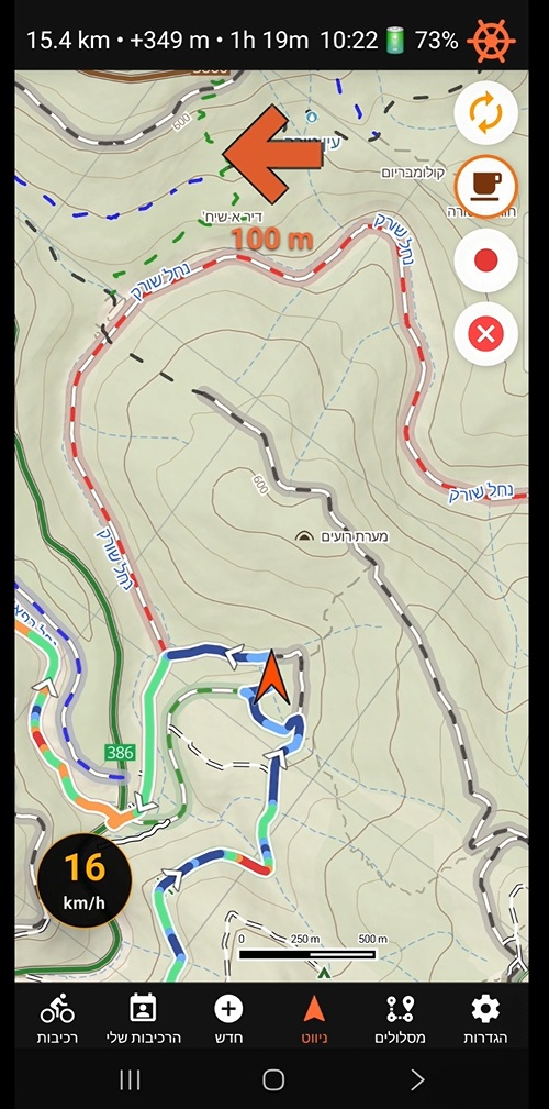
Turn alert arrow shown while navigating a GPX route

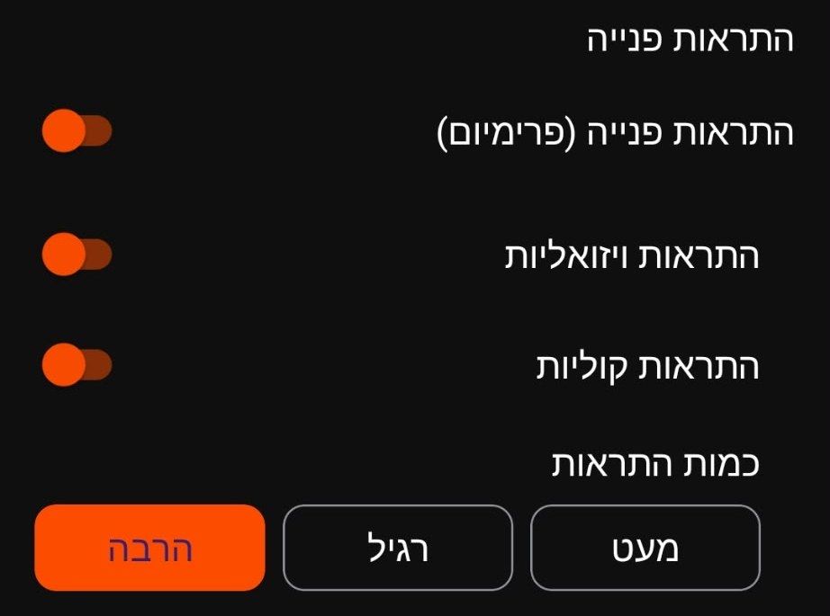
While navigating a loaded GPX route, Bishvil can alert you as you approach each turn — a visual arrow plus a spoken cue, so you can stay focused on the trail instead of constantly checking the map.

  • Early alert as a turn comes up.
  • A closer alert as you near the turn.
  • A clear "turn now" indication as you reach it.

Turn alerts are on by default for Premium. You can turn them on or off — and toggle the visual arrow and the spoken voice cues independently — from Settings → App.

Voice cues are prerecorded in Hebrew and English, matching your chosen app language.
Saved GPX Routes

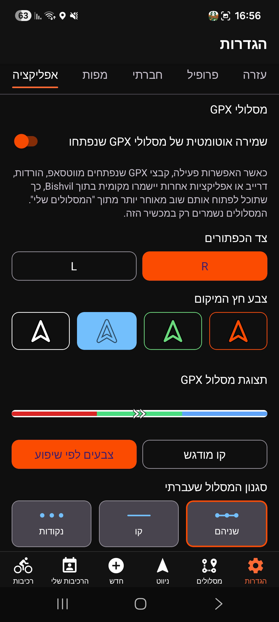
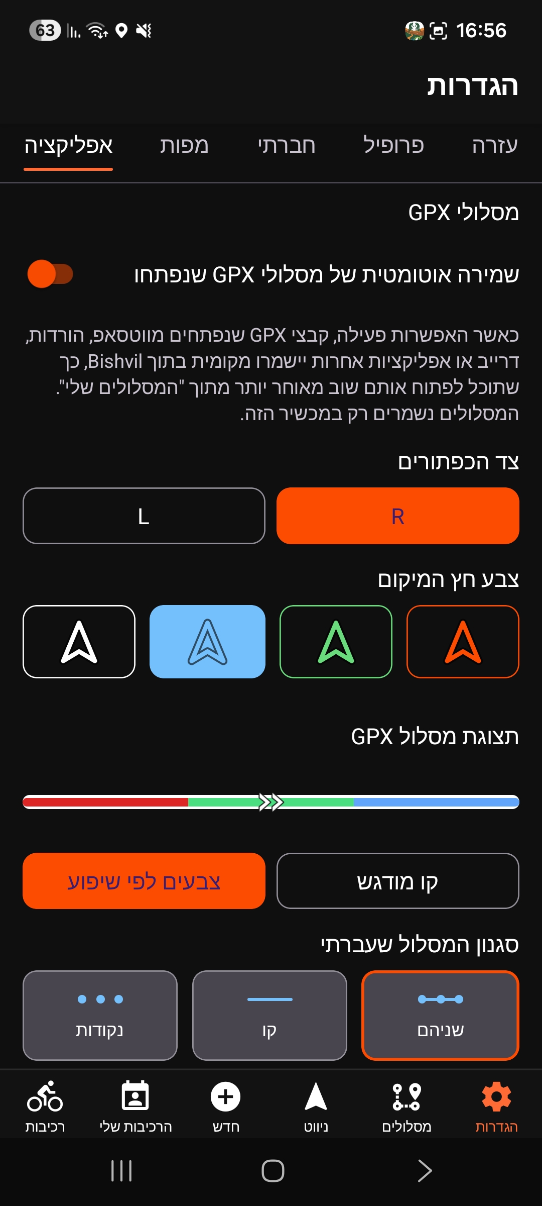
Settings → App → GPX routes: the auto-save toggle.

GPX routes auto-save toggle in Settings

Bishvil automatically keeps every GPX file you open, so you can reopen it later without hunting for the original file. This is on by default — GPX files you open from WhatsApp, Downloads, Drive, other apps, or the in-app file picker are saved locally so you can open them again from My saved routes. Saved routes are stored only on your device — no cloud sync, no account, nothing shared.

To turn it off, go to Settings → App → GPX routes and disable Automatically save imported GPX routes.

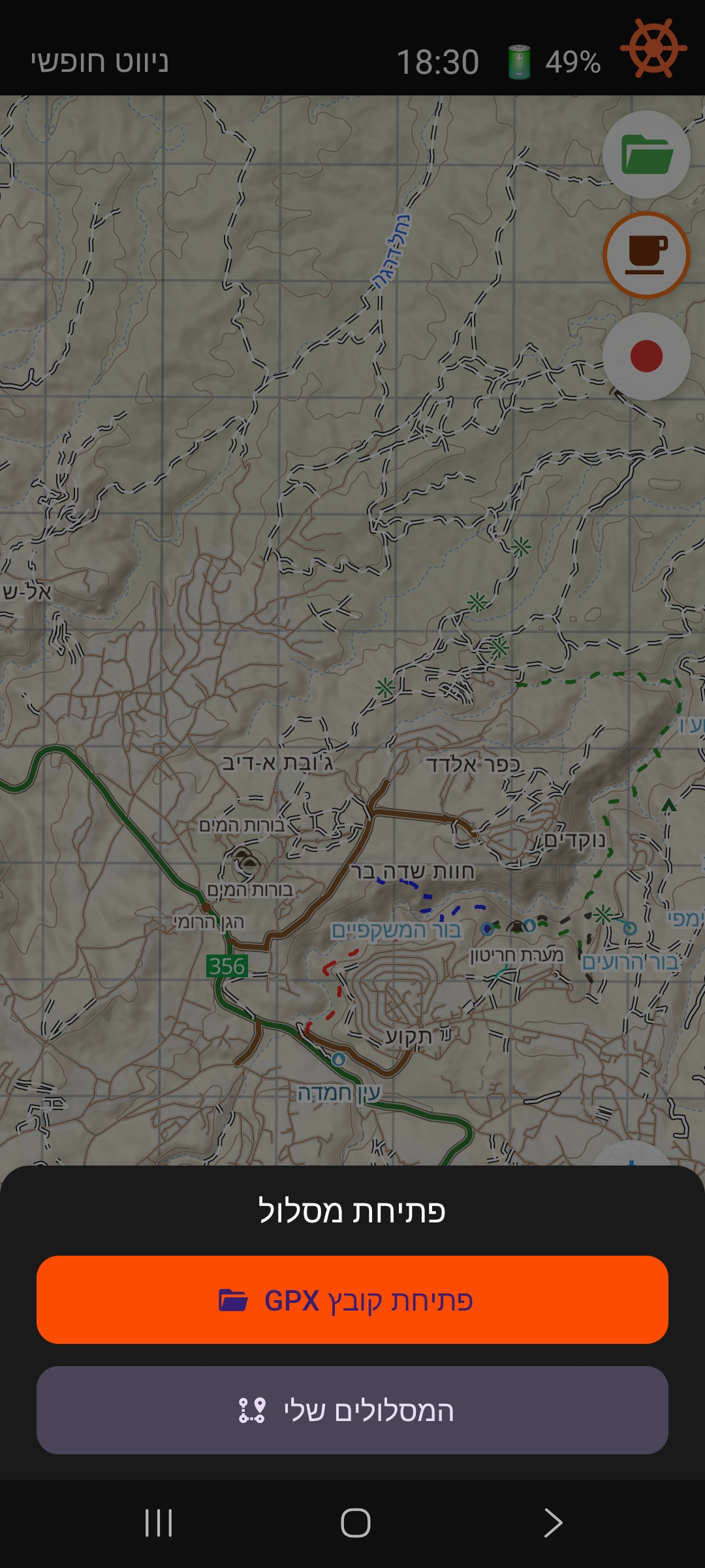
Opening a route — the green folder button:

  • No saved routes yet — tapping it opens the system file picker directly.
  • One or more saved routes — tapping it opens a small "Open route" sheet with two choices: Open GPX file (orange) opens the file picker, and My saved routes (muted) opens your saved list.
Open route bottom sheet with Open GPX file and My saved routes
The "Open route" sheet appears once you have at least one saved route.

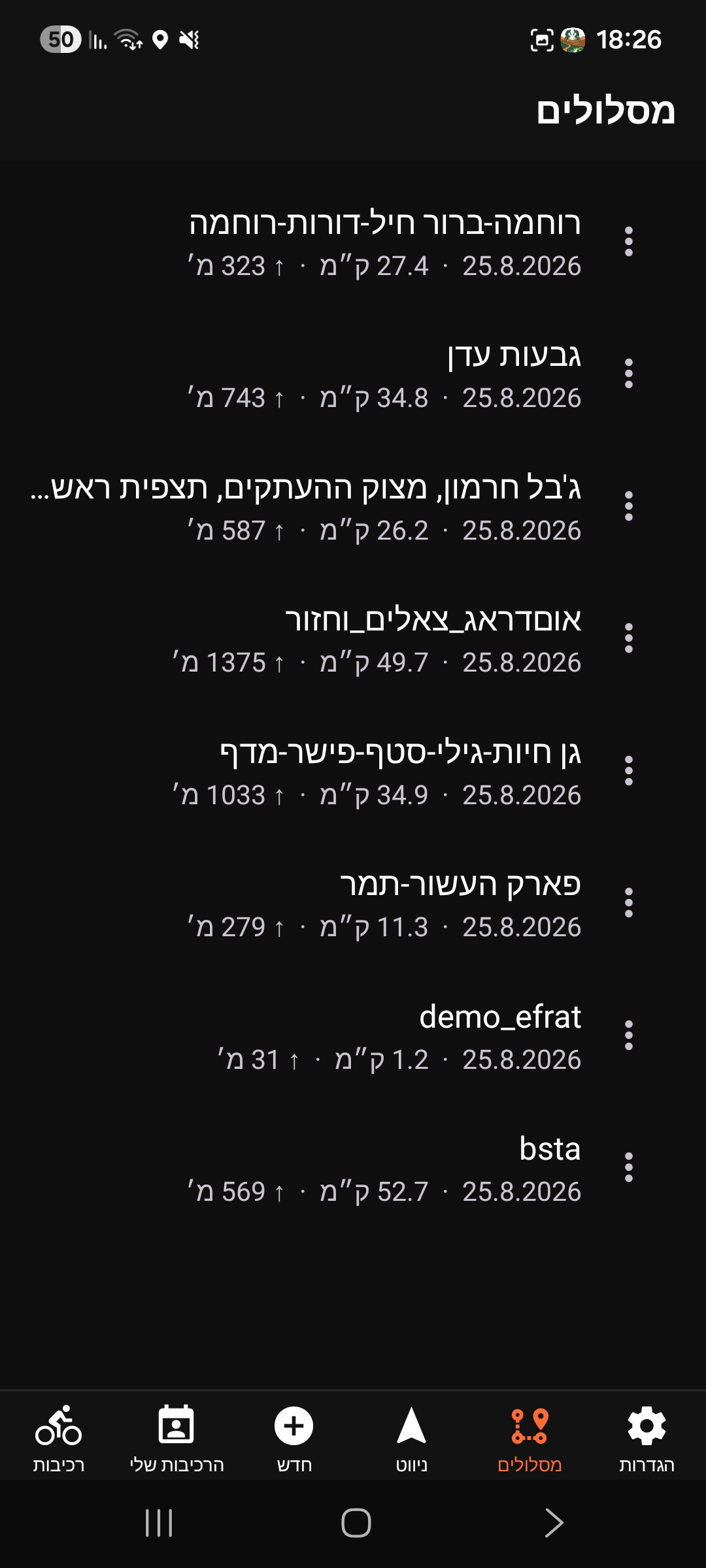
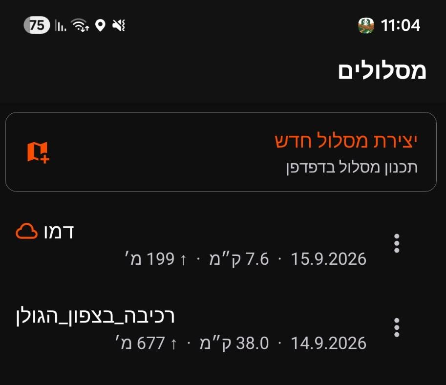
My saved routes:

Each row shows the route name, the date it was saved, and — when available — distance and elevation gain. Tap a row to open that route for navigation, complete with slope colors and elevation, exactly like a fresh import. Tap the trash icon to delete a route (after confirmation); this removes it from this device only.

My saved routes list with distance and elevation gain per route
My saved routes — reopen any GPX you have kept, fully offline.

Save behavior (when the toggle is on):

  • Opening a GPX from any source saves it and briefly shows "Route saved to My Routes".
  • Re-opening the same route does not create a duplicate — no toast.
  • Route names come from the GPX or filename; the fallback name is "Imported route".
  • If saving fails, the route still opens — only then you'll see "Route opened, but could not be saved."
This only covers GPX files you import yourself — rides, club routes, and routes attached to a ride aren't affected. Recorded rides (see Ride Recording below) are saved into the same list.
Coffee Points (Premium)

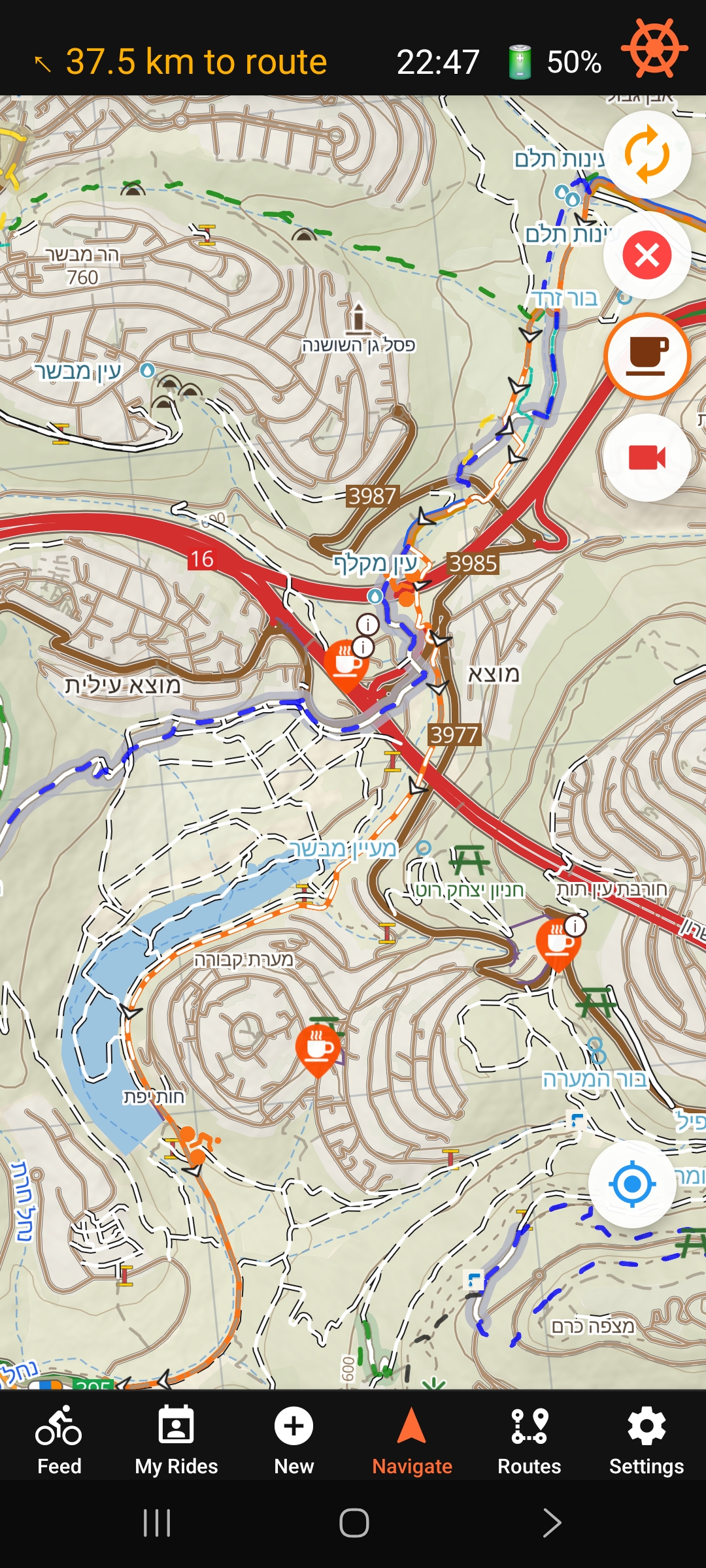
Coffee points along your route.

Cafes and bakeries shown on the map with outdoor seating

Tap the coffee cup button to show cafes and bakeries with outdoor seating along your ride. An orange ring around the button means the layer is on.

Two kinds of points appear:

  • Plain cup icons — cafes and bakeries from OpenStreetMap.
  • Cup icons with a small "i" badge — places Bishvil has curated with extra details.

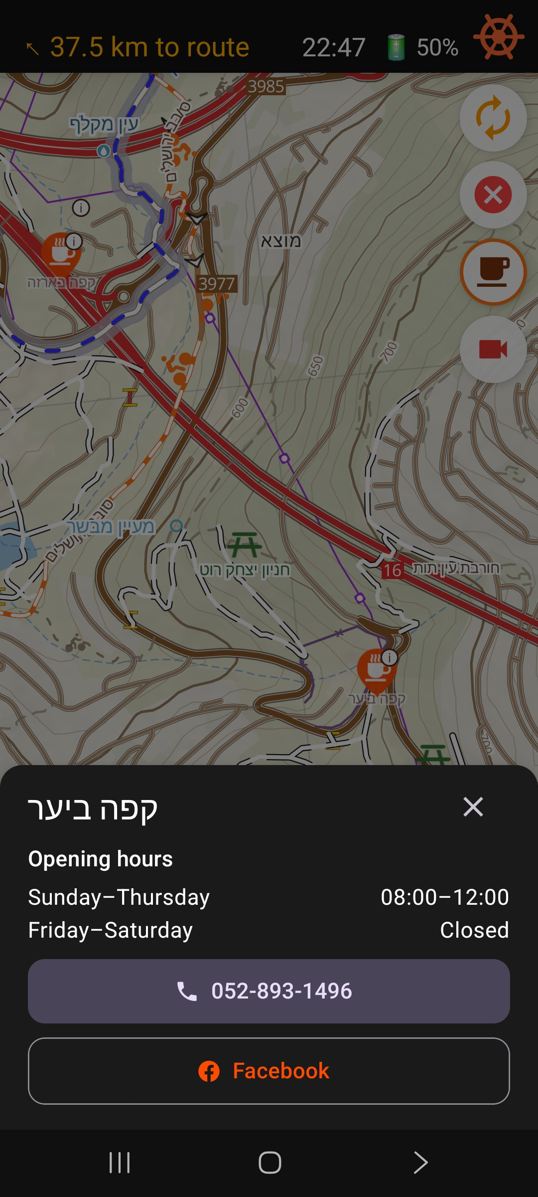
Tap a badged point to see its opening hours, phone number (tap to call), and links to its Facebook, Instagram, or website where available.

Cafe details panel with opening hours and phone number
Tap a badged coffee point for hours, phone, and social links.
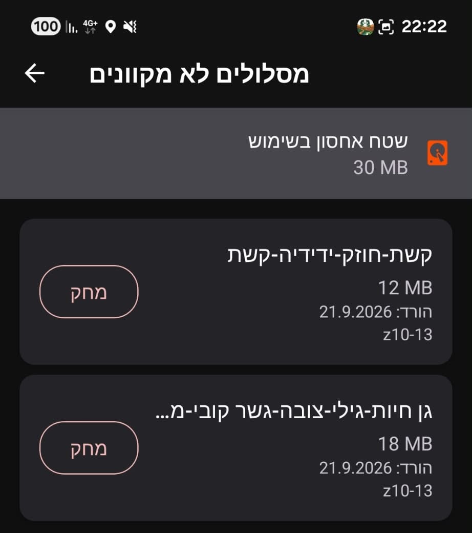
Coffee points work offline too — after installing the Full Israel map, download Coffee points separately from Settings → Maps to keep this layer available with no signal.
Ride Recording (Premium)

Recording in progress — tap the red button to stop.

Active ride recording with elapsed time and stop button

Tap the red video-camera button to start recording a GPX track of your ride. This works independently of GPX-guided navigation — record in free navigation or alongside a loaded route.

While recording, a timer pill appears below the top bar and the button turns into a solid red stop square. Recording keeps going if you switch tabs, lock the screen, or background the app.

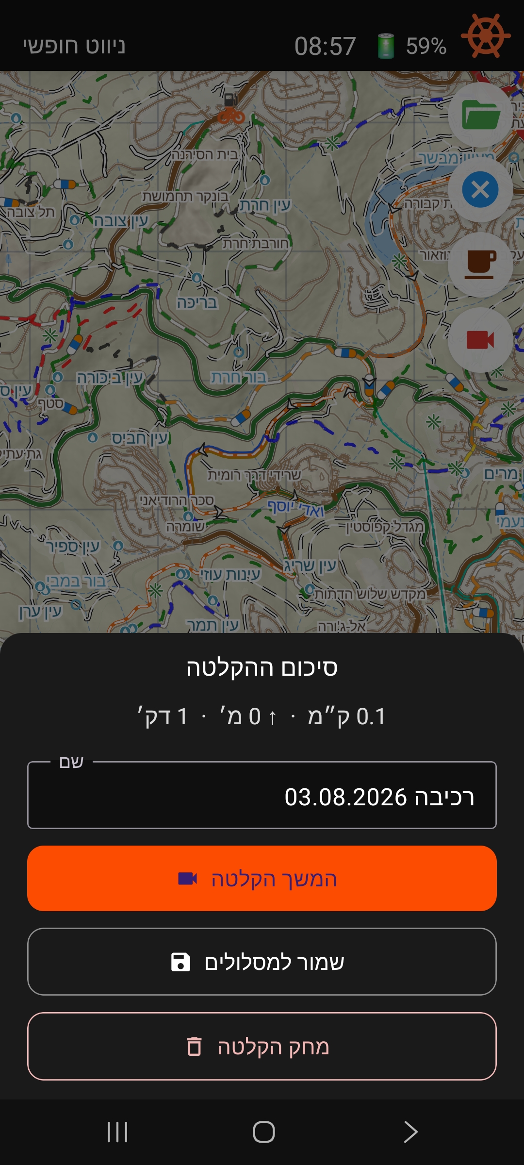
Tap the button again to stop. A summary sheet shows your distance and duration, with three choices:

  • Save to Routes — name your ride and save it; it shows up in My saved routes and the Routes tab, just like an imported GPX.
  • Continue Recording — resume the same session instead of starting a new one.
  • Discard recording — delete it (asks for confirmation once you've recorded something meaningful).
Recording summary sheet with Continue, Save, and Discard options
Stopping a recording shows distance, duration, and Save / Continue / Discard.
If Bishvil is closed unexpectedly mid-recording, reopening the app offers to save or discard whatever was captured — nothing is lost silently.

Past trail: while recording, the map traces everywhere you've ridden this session in your chosen style (Settings → App). The trail appears automatically once recording starts and disappears once you save or discard the ride.

🗺️Routes
Your Saved Routes (Premium)

The Routes tab — every imported and recorded route in one place.

Routes tab showing a list of saved rides with distance and elevation

The Routes tab is a premium view of the same saved-routes list the free green-folder button already gives you — imported GPX files and your recorded rides, all in one place, sorted by most recently opened or saved.

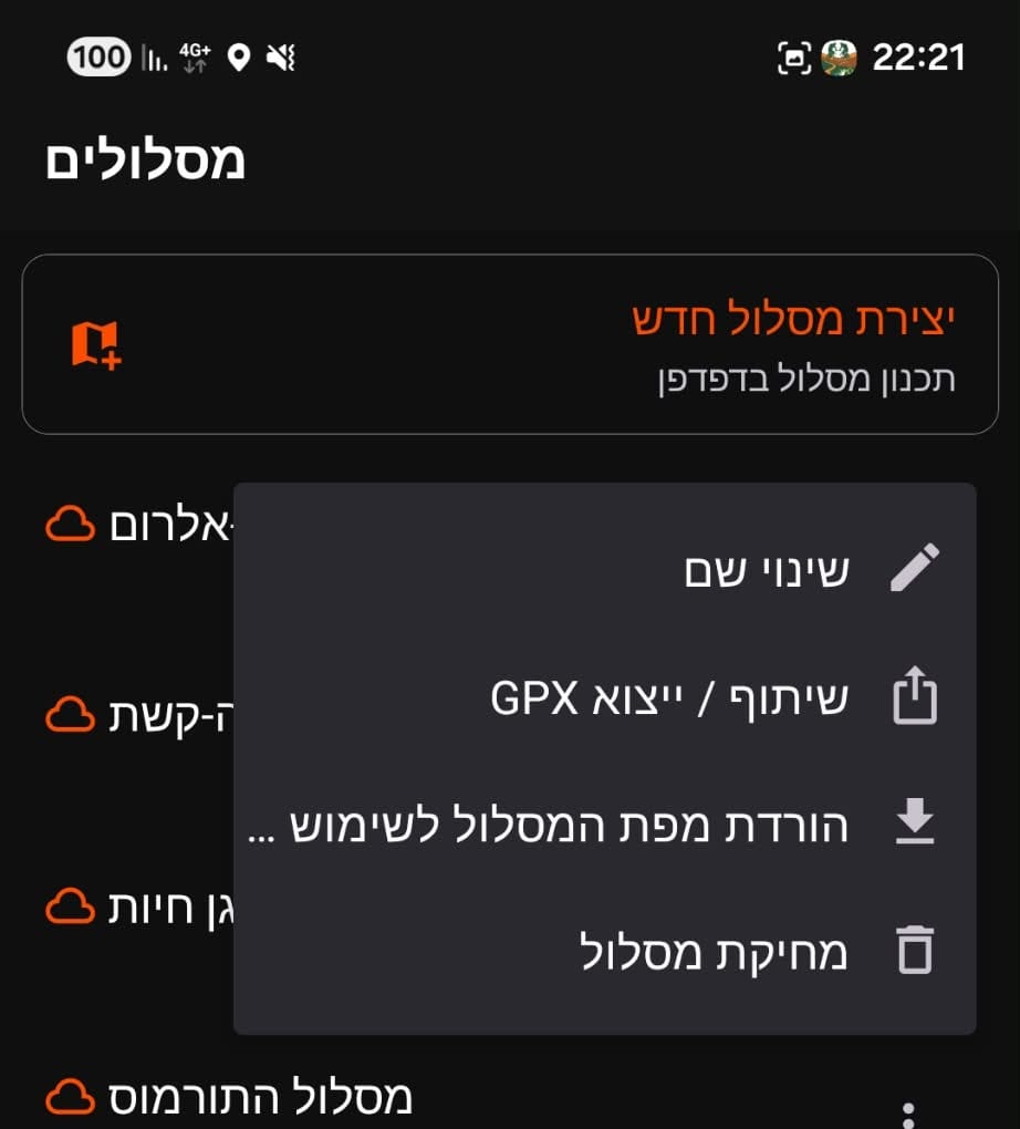
Tap a route to open it for navigation. Tap the ⋮ menu on a row for:

  • Rename — change the display name (doesn't touch the GPX file itself).
  • Share / export GPX — send the file via the Android share sheet, e.g. to WhatsApp or email.
  • Delete route — remove it from this device only.

Opening and deleting a route are always free, from the green folder button on the Navigate tab. Renaming and exporting a GPX file are Premium features, available here in the Routes tab.

👥Rides & Social
Feed

Tap the Feed tab to browse upcoming rides posted by other riders in Israel.

Each card shows:

  • Ride type, date and time, area, and organizer name
  • Skill level, pace, and participant count (X / Y spots)
  • "Following" badge — ride organized by someone you follow
  • "X you follow joined" — a followed rider has already joined

Tap a card to open full details and join:

  • Express ride — tap Join and you're in immediately.
  • Approval ride — tap Request; the organizer approves or declines.

Tap the filter icon to narrow by: ride type, skill level, time range (Today / 7 / 14 / 30 days), and distance from your location.

My Rides

Tap the My Rides tab to see all rides you are connected to.

  • Active tab — upcoming rides you are organising, have joined, or requested to join.
  • History tab — completed rides from the past 30 days.

Tap any ride to view details. If you are the organizer, manage participant requests (approve or reject) from the ride details screen. Updates appear in real time.

New Ride

Tap the + New button (center of the tab bar). A 5-step wizard guides you through:

  • 1. When — pick the date and start time.
  • 2. Where — tap anywhere on the map to set the meeting point.
  • 3. Details — choose ride type, write a description, optionally attach a GPX route.
  • 4. Group — skill level, pace, max participants (2–6), join mode (Express or Approval), gender preference.
  • 5. Review — confirm everything, then publish.

Once published, the ride appears in the Feed for riders whose preferences match.

Attaching a GPX route lets participants preview the trail on the map before joining.
👤Profile & Account
Your Profile

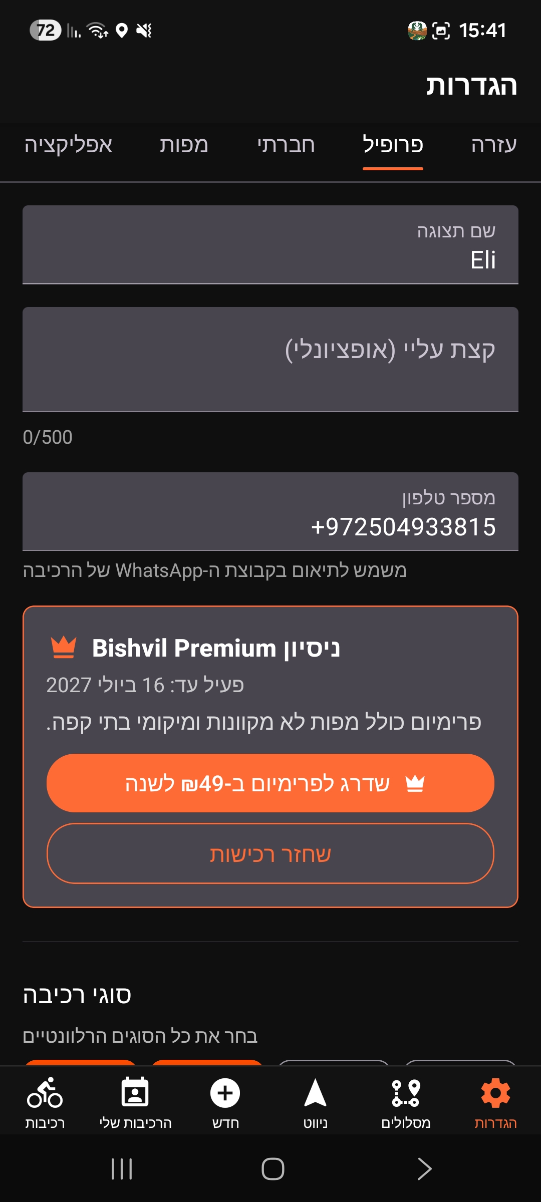
Settings → Profile — the Premium Status card.

Settings Profile tab showing the Premium Status card

Go to Settings → Profile to view and edit your account (Profile moved here from its own bottom tab — that slot is now the Routes tab).

Editable fields:

  • Display name, bio, and phone number.
  • Ride types (multi-select): Trail, Enduro, Gravel, Road.
  • Skill level, pace, birth year, and gender.

Tap Save to apply changes. These preferences affect which rides appear in your Feed and which riders see your rides.

The Premium Status card shows where you stand: on trial (expiry date + Subscribe), expired / not subscribed (Subscribe), or subscribed (expiry date + Manage subscription). All new users receive a 30-day premium trial automatically, and Restore purchases is available if you've subscribed on another device.

Bishvil Premium is ₪49/year and unlocks offline maps, coffee points, ride recording, and route management (rename/export) in the Routes tab.

Tap Sign Out at the bottom to log out.

⚙️Settings & Map
App
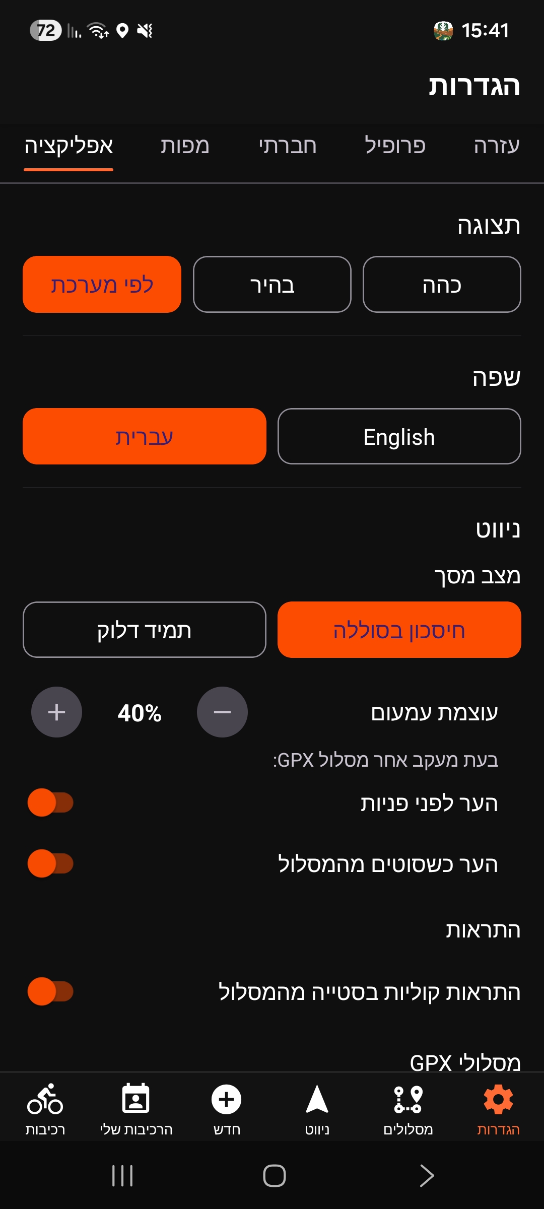
  • Theme — System / Light / Dark.
  • Language — Hebrew / English. Switches the full app UI immediately.

Screen Mode (Navigation tab only):

  • Always On — screen never dims during navigation.
  • Balanced — dims after 10 s idle while moving (30 s while stationary). Tap anywhere to wake.
  • Dim brightness — slider to set dimmed level (30–80%).
  • Wake before turns (GPX only) — screen wakes as you approach a turn.
  • Wake when off-route (GPX only) — screen wakes when you leave the route.

Off-route alerts — toggle sound alerts on/off for GPX navigation. Double beep on leaving route, chirp on return.

Settings App tab: theme, language, screen mode, and alert toggles
Settings → App: theme, language, screen mode, and alert toggles.

Turn alerts (Premium) — a master toggle, plus separate Visual alerts and Voice alerts toggles so you can choose which cues you get.

Turn alerts settings with master, visual, and voice toggles all on
Settings → App: Turn alerts — master, visual, and voice toggles.

GPX routes — Automatically save imported GPX routes (on by default). When on, GPX files you open are saved locally on this device so you can reopen them from My saved routes. See Saved GPX Routes under Navigation.

Navigation:

  • Buttons side — Left / Right. Moves all overlay buttons (folder, trail clear, coffee cup, record) to the chosen side. The mode toggle (compass/ship wheel) is always pinned to the right edge of the top bar regardless of this setting.
  • Location arrow color — white, blue, green, or orange.

GPX route display — choose how a loaded route's line looks:

  • Slope colors (default) — the line is colored by grade: steep descent, descent, flat, ascent, steep ascent.
  • Highlighted line — a single solid color of your choice (orange, green, blue, or purple).

Past trail style — choose how the breadcrumb trail is drawn during an active Premium recording: dots (default), a thin line, or both together.

Settings App tab: buttons side, arrow color, route display, and past trail settings
Settings → App: buttons side, arrow color, route display, and past trail.
Maps

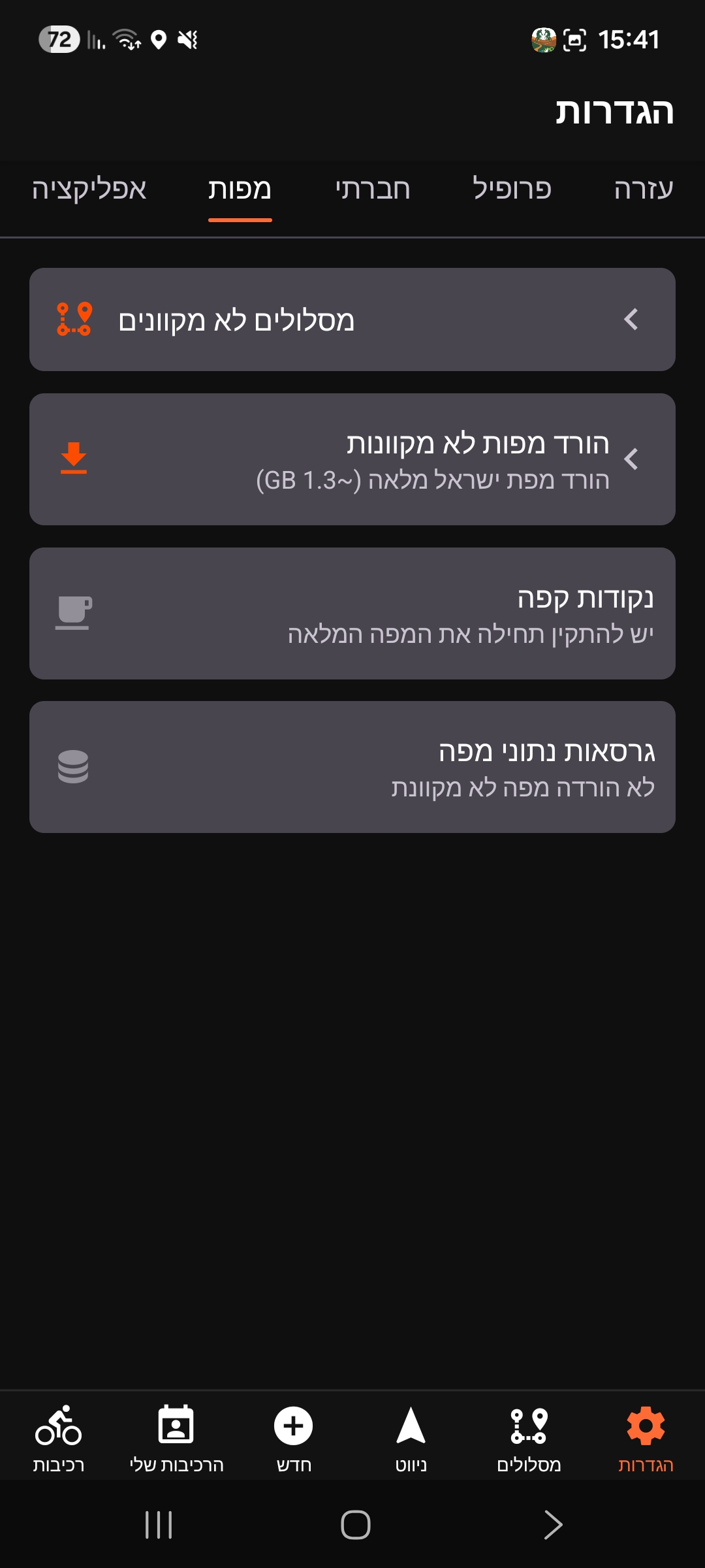
Download offline map packs so navigation works without any mobile signal.

Full Israel Map (premium, ~1.3 GB): downloads the complete Bishvil MTB map to your device. Once installed, all features — slope colors, coffee POIs, offline rendering — work with no internet.

All new users receive a 30-day premium trial automatically, so the Full Israel Map is available to try right away.

Coffee points (premium, requires the Full Israel map first): downloads the cafes/bakeries layer separately, so it also works offline. Updates independently of the main map — the row shows when a newer version is available.

Map data versions shows your installed MTB tile version and POI version with download date.

Settings Maps tab with offline map, coffee points, and data versions rows
Settings → Maps.
Social

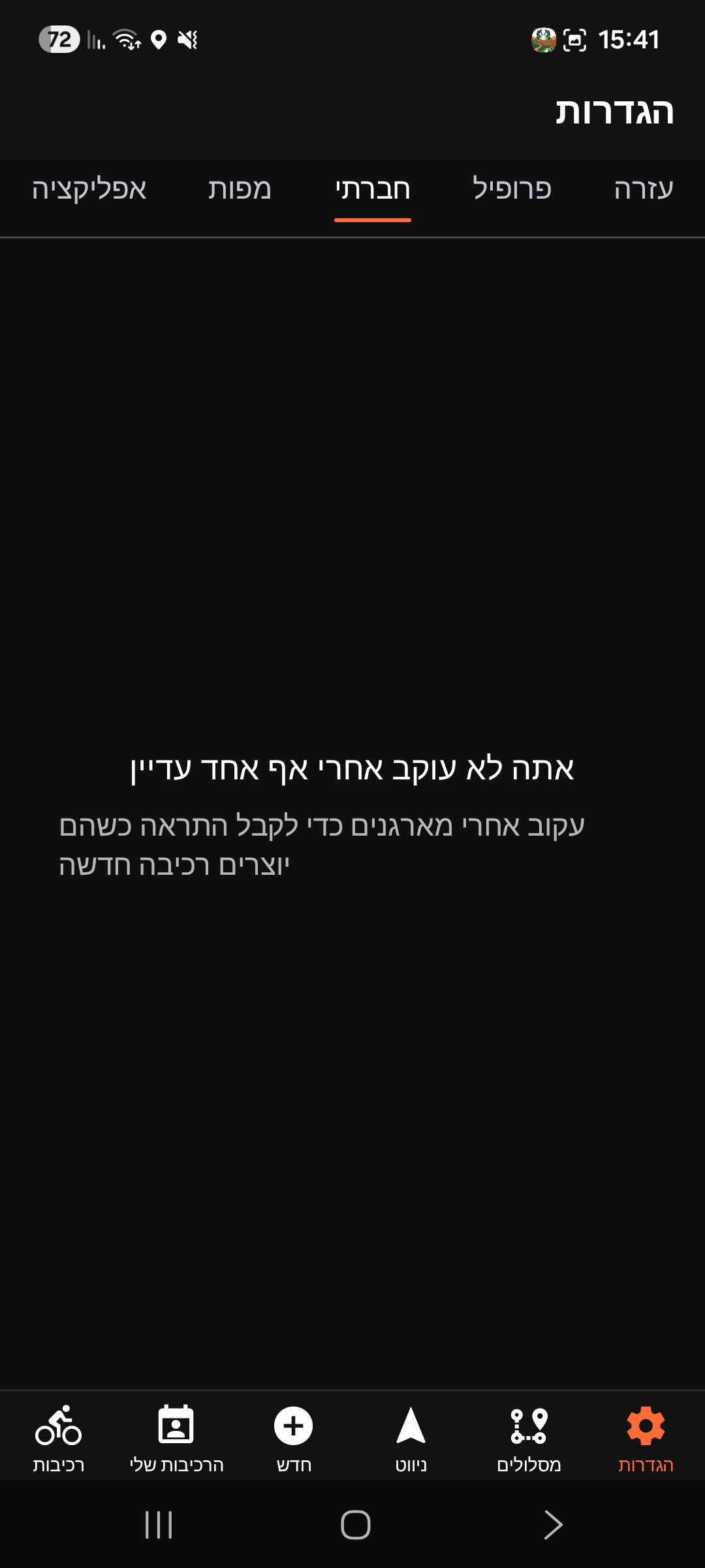
Shows every user you follow with their ride stats (organised and joined).

  • Tap a name to open their profile.
  • Tap Unfollow to stop following directly from this list.

You receive a Feed notification when a user you follow creates a new ride.

Settings Social tab, empty state before following anyone
Settings → Social (empty until you follow someone).
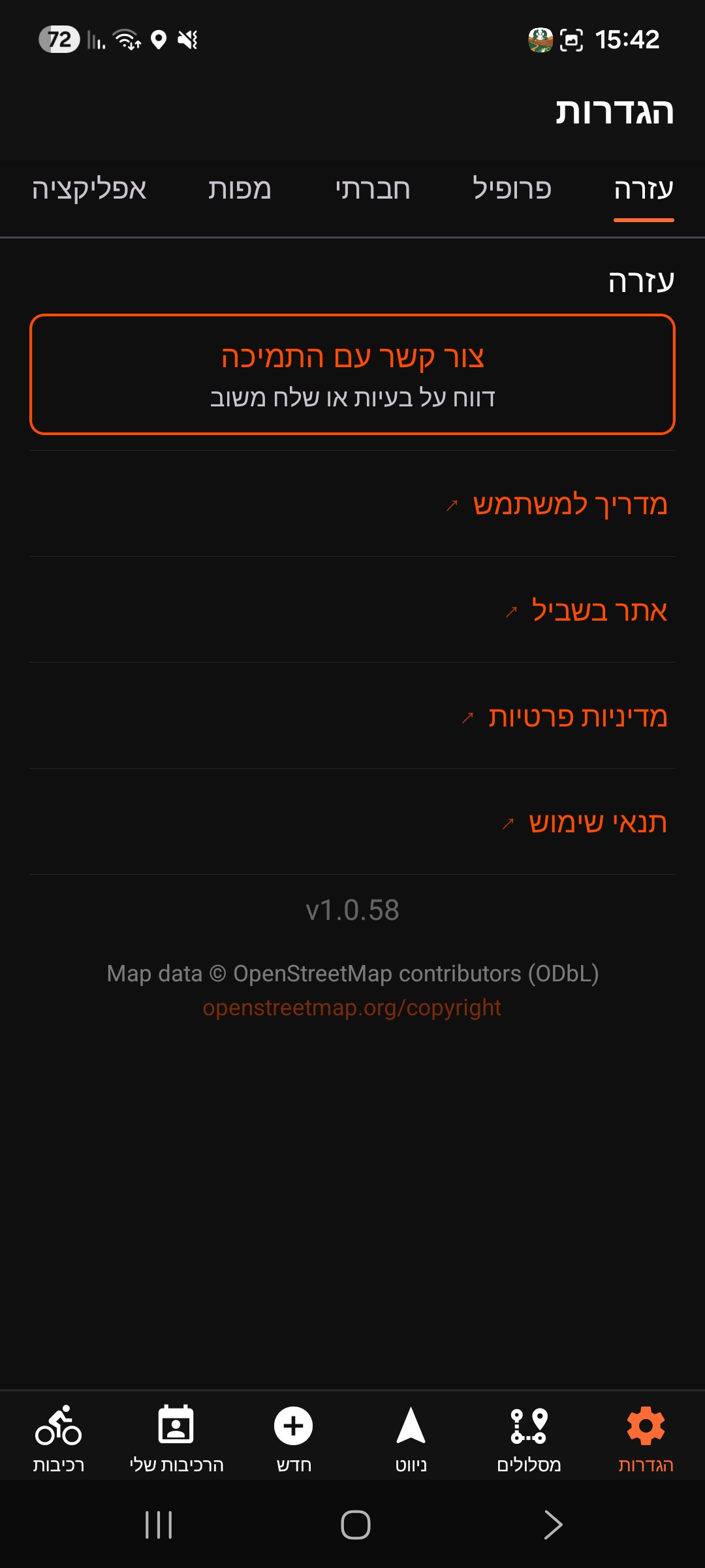
Help

Contact Support opens a pre-filled email with your app version, device model, and navigation mode included — just describe the issue and send.

  • User Guide — opens this guide.
  • Bishvil website, Privacy Policy, and Terms of Use.

The app version number is displayed at the bottom of this tab.

Settings Help tab with support and links
Settings → Help.